¶ Export Image Bounded by Polygon
The export image bounded by polygon tool is very useful for extracting high-quality images from point clouds. If the user wants to export ortho images based on a point cloud, please check the Export Raster function.
This function can use a polygon of any position to export the image. For practical reasons, using a rectangular polygon, where all corner points fall into a single plane, is highly recommended. This plane will be the "cutting plane", where the image content will be projected. This plane can be placed vertically, horizontally or angled, meaning the user can extract facades or ceiling paintings into a single image. The output file won't be georeferenced, and the format is TIFF.
Before using the function, a polygon SHP shall be created, and the polygon shall be placed. The polygon's position shall be around the object that is imaged.

After the polygon has been set, start the tool. A settings window will appear, where the user can set the parameters for the export.
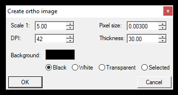
The settings can affect the output. The pixel size and the DPI are dependent on each other.
- Scale - This will be the output scale for the image.
- Pixel size - This will define the pixel size, which also affects DPI
- DPI - This will define the DPI, which also affects the Pixel size
- Thickness - This is the main parameter to create the "slice" from the point cloud. If the value is set to 0, only those points will be included in the clip, which is precisely on the "plane" of the polygon. If set to 10 cm, the software will take the plane from the polygon and +5-5 cm from each direction (10 cm thick slice of the point cloud) to create the image. In the given example, 5 meters were used to include all the points of the facade.
- Background - Set the background colour.
The example result can be seen here:
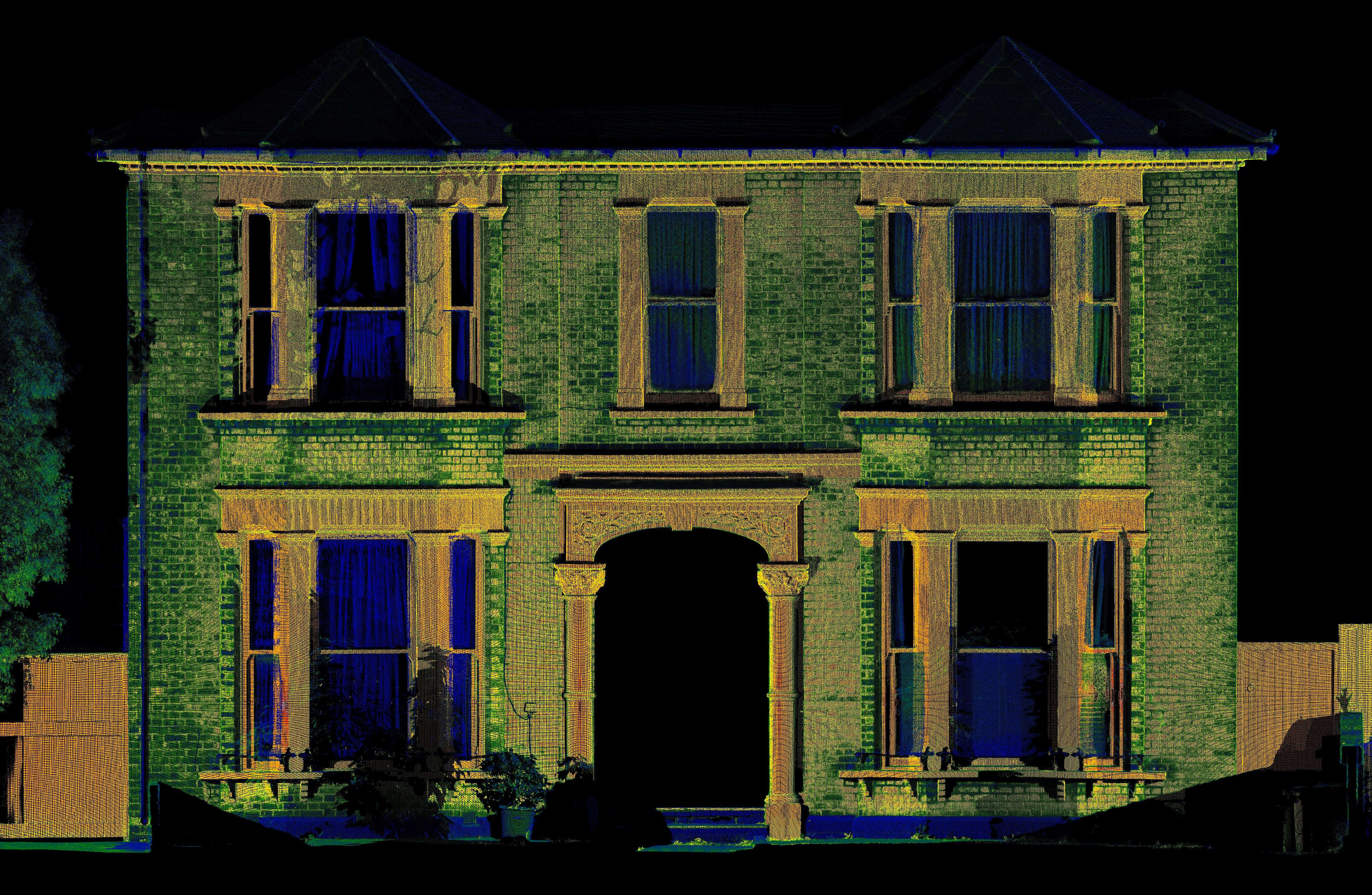
Please note that the provided example file has a significantly reduced image quality. The original TIFF file is ~50 mb. Modifying the settings can result in more or less detailed images, and the scanner type is also crucial for the output quality. The output image colours will be aligned with the active point cloud colouring in the software.