¶ Export Hillshade
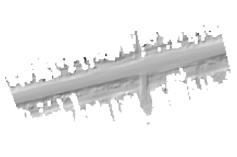
The hillshade export functionality allows the user to export a “shaded” raster from the selected classes of the point cloud. This can help to highlight classification errors, for example flying points in the ground class or create a georeferenced raster from the surface as seen in the example image below.
The software offers various settings in order to customize the output. The output file will be a georeferenced TIFF file.
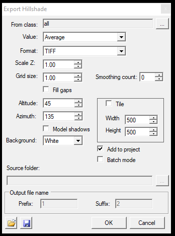
The settings are the following:
- From class - The user can specify, which class or classes shall be used for the hillshade generation
- Value - Specify within the grid size the lowest, highest or average value that shall be used for the hillshade generation
- Format - Select the designated format for the output
- Scale Z - Set the scale of the Z dimension to a higher value to amplify the output so that even smaller differences become more visible
- Grid size - The output grid is equal to the raster pixel size, by default 1 pixel is a 1x1 m area
- Fill gaps - The software will interpolate the gaps in the raster if there is insufficient amount of points to render it
- Smoothing count - The user can use this parameter to anti-alias the result
- Altitude and Azimuth - Set the “sun's” position so that the shadows will be “presented” from the set location
- Background - Set the background colour for the raster
- Tile - Width and Height - If the output is too big for a single raster file or there is a need to split it, the software can automatically tile the output based on the provided width and height dimensions, which are understood in meters
- Add to project - The output will be automatically added to the project
- Batch mode - Selecting this option will allow the user to select a Source folder, and the software will perform the hillshade generation for each LAS file in the given folder with the set parameters
- Output file name - If the Batch mode is selected, prefixes and suffixes can be appended to the generated filenames
- Load Hillshade Settings - Load a previous setting to be run inside the current project
- Save Hillshade Settings - Save the current settings to be used later
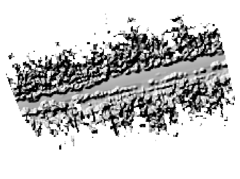
It is recommended to use this function with a classified cloud or with an ALS dataset, as using it with a TLS or MLS dataset - which are unclassified - might not provide the result which would be informative for the user. See a bad example below, where too many classes remained turned on.