¶ Properties
On this page, users can check the summary of properties inside the Project Explorer. These properties can adjust settings for rasters, clouds, vectors, trajectories, and geophotos.
¶ Raster Properties
The properties of the rasters can be checked only for a single raster.
The raster properties show the general properties of the rasters, and a few settings can be made here. The grey lines cannot be modified.
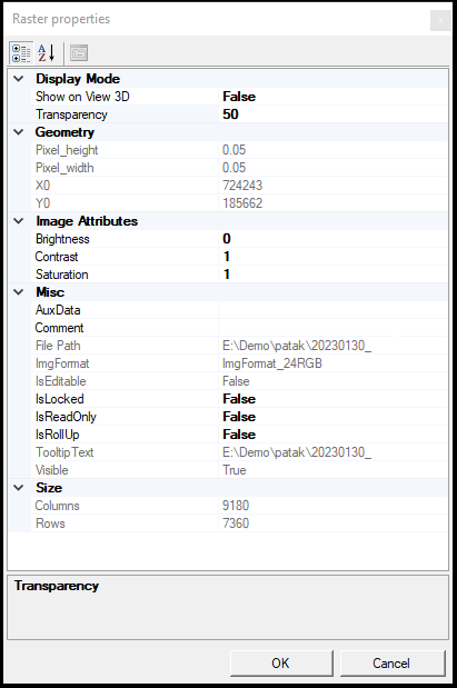
The description of the settings is the following:
- Display Mode - Set the display settings for the image. The settings are currently disconnected.
- Geometry - The geometrical properties of the image, such as pixel size or the extent's top left coordinate.
- Image Attributes - The user can adjust the image's brightness, contrast and saturation here.
- Misc - Some additional data can be read here, including file paths.
- Size - Number of columns and rows.
The properties panel is not available if multiple rasters are selected.
¶ Cloud properties
The properties of the clouds can be checked at Clouds level and for each single cloud file.
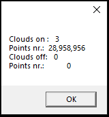
If the Properties are selected from the Clouds right-click menu, the tool will bring statistics of all point clouds loaded into the project.
The cloud properties show the general properties of the clouds, and a few settings can be made here. The grey lines cannot be modified.

The description of the settings is the following:
- Color - The user can set the default colour for the cloud. The clouds can be coloured by default colour from the Point Cloud toolbar.
- Compressed - The loaded cloud file is uncompressed (LAS) or compressed (LAZ).
- Density - The area of the point cloud's extent and the cloud's average density can be read here.
- Extent - The extent of the point cloud in XYZ dimensions.
- GeoTags - Geotags can be read here if applicable.
- Intensity Range - The intensity range of the cloud. Can be 8 bit (0-255 values) or 16 bit (0-65535 values)
- Misc - Miscellaneous information about the LAS file, including file paths, header and VLR information, and LAS version and point data format.
- Number of Points - Number of points based on the return number and total number of points. Not all scanners support return number storage; the information might not be coded to the LAS files.
- Offset - The offset values from the coordinate system origo.
- OGC - Open Geospatial Consortium parameters of the cloud.
- Optimization - Shows the current optimization type and the number of points loaded into memory.
- RGB range - The RGB range of the cloud. Can be 8 bit (0-255 values) or 16 bit (0-65535 values)
- Scale - The scale factor of the cloud. This parameter displays only the dimensions, so a 0.001 value refers to a mm resolution cloud.
The properties panel is not available if multiple clouds are selected.
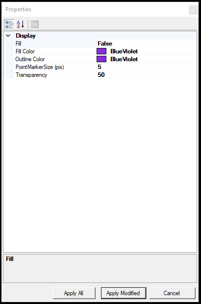
¶ Vector Properties
The properties of the vector files can be checked for each vector if multiple vectors are selected. This section lists properties based on vector types, including multi-selection.
SHP/FDB table - Single element properties:

- Display - The user can adjust the display settings in this section. Fill is understood only for polygon features.
- Extent - The extent of the SHP file. Empty SHP files will have an extent of 10,10, and -10,-10.
- Miscellaneous - This area provides information about the vector file itself. The Automatic Identifier is the ID incremented as a new object is created; this is automatic for SHP files created inside PCS. The Automatic Label can label the elements in a 2D view based on an attribute. The rotation column is necessary for CAD-based extractions and applies only to point SHP files. The Symbol Library is required for blocks, where the user shall specify the path to the seed file where the software will reach the block definitions. If the library is set, the user can select the Symbol name field. After changing these settings, the SHP file shall be saved and re-opened for the changes to take effect.
- View3D-Display - Set the 3D display size for the SHP.
SHP/FDB table - Multiple element properties:
- Display - If multiple SHP or FDB tables are selected.
DXF/DWG file properties:
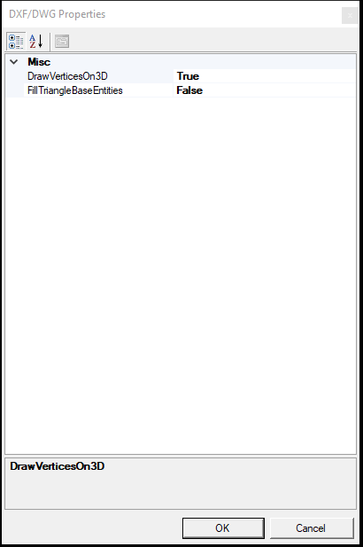
- Misc - The properties are minimal because PCS only displays the DXF/DWG file but cannot modify it.
Triangulated TRI properties:
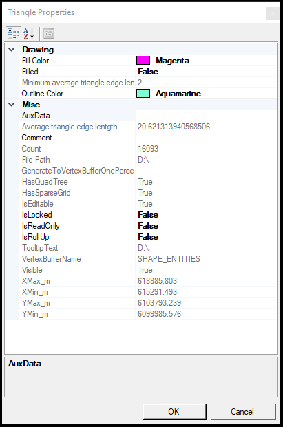
- Drawing - The display properties of the triangulated file
- Misc - General parameters and information about the triangulated surface, including file paths and dimensions.
¶ Trajectory properties
The properties of a single trajectory can be inspected inside PCS.
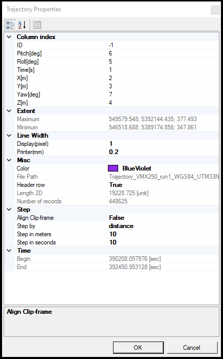
- Column index - Currently under development.
- Extent - The extent of the trajectory's area
- Line width - Display setting for the trajectory line
- Misc - Basic information of the selected trajectory.
- Step - The step count for the step tools. Currently under review.
- Time - The start and end time of the trajectory in GPS seconds.
¶ Geophoto properties
The properties of the geophotos can be checked for single and multiple geophoto records. Camera calibrations have no properties function.
Single geophoto record properties:
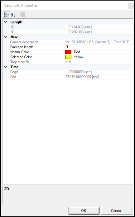
- Length - The length of the selected camera record from the first to the last camera location in meters.
- Misc - Display parameters and camera description for the selected geophoto record
- Time - Relative time in seconds.
Multiple geophoto properties:
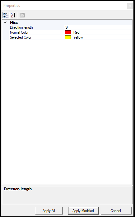
- Misc - Display properties for multiple geophoto records can be adjusted here.