¶ Export Raster
The export raster tool creates a raster (an orthoimage) from the point cloud with the given settings. If the user wants to export facades or detailed sections of a point cloud, please check the Export Image Bounded by Polygon function.
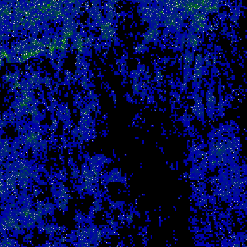
The output raster will be georeferenced. This tool can be very effective if a 2D extraction is needed, as a raster image is way “lighter” than a LAS file, but you can also extract vectors using rasters in the software or transfer this raster to CAD software. See an example of the exported image with a default coloured point cloud below:
After the start of the tool, the following settings can be set:
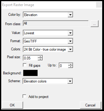
- Color by - Select the LAS value based on which you would like to create the raster
- From class - Select the used classes
- Value - Select the value setting for the export. Using Elevation colouring, the lowest setting will seek the lowest Z value in the given pixel size.
- Format - Output format of the image
- Colors - Colour range for the output raster image
- Pixel size - Set the pixel size in meters for the output file. 5 cm is the lowest setting for the raster export.
- Fill gaps - This option will fill the gaps with interpolated values up to the selected value from the up-to-dropdown menu.
- Background - Select the background colour.
- Schema - Select the colour schema based on which the user would like to colourize the output raster.
- Add to project - Load the raster directly to the project after the creation.
Selecting a high-resolution for a bigger LAS file or more extensive area might take some time to render. During the export, the software seems stuck. After pressing OK, please wait until the setting window disappears; it will indicate that the export has been finished.