¶ WMS layer
WMS layers are rasters accessed over the internet from open or restricted sources and can provide additional information during extraction work. The functions can be accessed by right-clicking on the Project Explorer - Rasters level and selecting Create a WMS Layer option. The function will open a settings window, where the user can name the connection and provide the connection link and the user credentials.
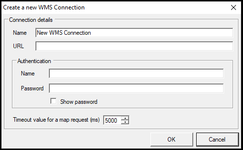
After the details are provided, press OK, and the function will show the user the available raster layer, from which the user can select what is needed. After loading the layer, it behaves as a raster layer inside PCS. Please note that, if the used source is freely accessible, the username and password can be left empty.
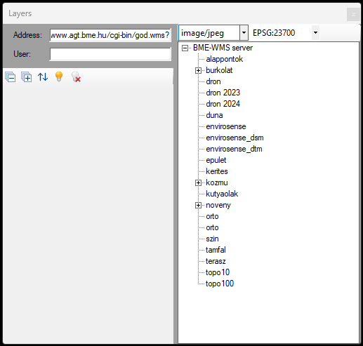
The user can double-left click to the selected layer, and add it to the current project.
¶ Trivia
- The WMS functionality was unavailable for a longer period, and it become operational from PCS version 2024.06.25