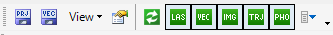
¶ Standard toolbar
In this section, the main window's standard toolbar is described.
The definition of the tools are the following:
- Save Project File (vectors are not saved) - This function will save only the project file, but vectors and point clouds are not saved
- Save Current Vector - The currently active vector will be saved
- View dropdown - This dropdown allows the user to open windows if they are not opened or closed
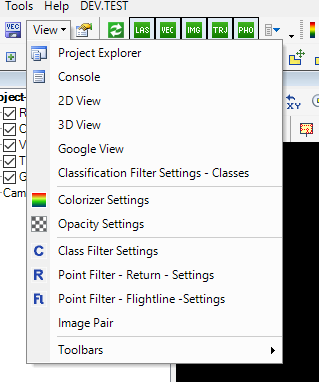
Project Explorer - Opens the Project Explorer window
Console - Opens the console window
2D View - Opens the 2D view window
3D View - Opens the 3D view window
Google View - Opens the Google Maps window. For a detailed description of this tool, please check this page.
Classification FIlter Settings - Classes -The classification from-to settings panel lets the user define the source and target classes.
Colorizer Settings - The colour settings for elevation, intensity, the return number and the number of returns. The same settings can be reached from the Point Cloud toolbar.
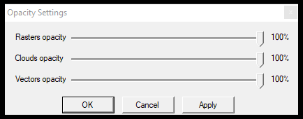
Opacity Settings - The settings panel where users can set opacity for rasters, point clouds and vectors.
Class filter settings - Set the visible classes for 2D and 3D views. The same settings can be reached from the Point Cloud toolbar.
Point Filter - Return - Settings - Turn on and off discrete return numbers. The same settings can be reached from the Point Cloud toolbar.
Point Filter - Flightline - Settings - Assign colours for different flightline attributes. The same settings can be reached from the Point Cloud toolbar.
Image Pair - This function allows the user to use the image pair view. Find the detailed description of the image pair view in this article.
Toolbars Dropdown - Reset/Save/Load Toolbar settings. The user can clear all hotkey settings from this menu.
- General Settings - Find the general software settings here. A detailed description is available by clicking here.
- Refresh - Refresh the view if some settings are changed and accidentally close the Standard toolbar, which is not updated automatically. Affects 2D view only.
- Display LIDAR points on/off - Turn on/off the point cloud visibility in all views. Using this will uncheck the Clouds in the Project Explorer.
- Display Vectors on/off - Turn on/off the vector visibility in all views. Using this will uncheck the Vectors in the Project Explorer.
- Display Rasters on/off - Turn on/off the raster visibility in all views. Using this will uncheck the Rasters in the Project Explorer.
- Display Trajectories on/off - Turn on/off the trajectory visibility in all views. Using this will uncheck the Trajectories in the Project Explorer.
- Display Geophotos on/off - Turn on/off the geophoto visibility in all views. Using this will uncheck the Geophotos in the Project Explorer.
- Create Pop-up - Create a menu from this toolbar.
¶ Known bugs
- If the user accidentally closes the Standard toolbar, it cannot be re-opened, just like other toolbars. If this happens, use the File/Use Default Layout option and create a new empty project to get back the standard toolbar.